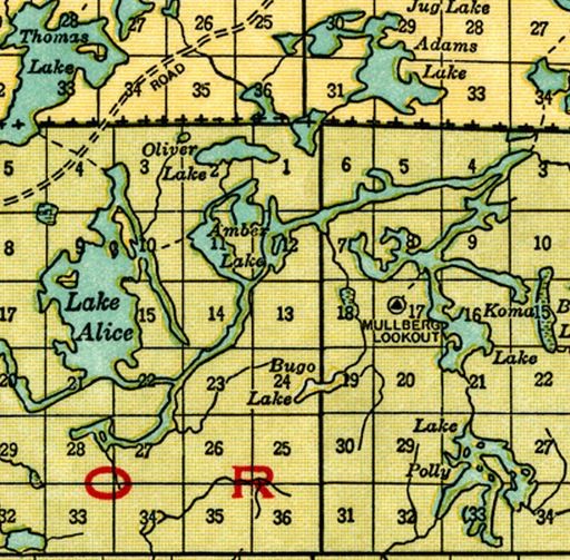
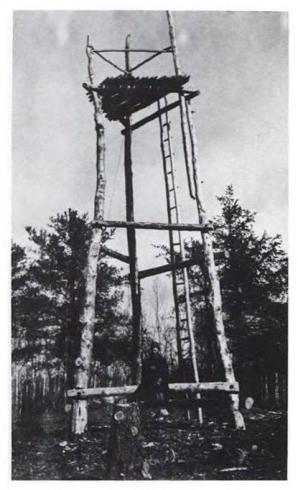
I discovered the location of Fire lookout called Mullberg, which never made it to post World War II listings, when examining a 1920 map of the Superior National Forest located next to a lake now called Malberg, on a high point within 1/2 mile of the lake shore. I have found picture of a 1916 crude wooden structure. The map, showing a trail to the shore of the lake, gives no indication of a telephone line and trail, without such communication the tower would be useless. I suspect any phone line would have run south intersecting the line from Baird to Wanless.
I and some companions bushwhacked about 3/4 mile to the site in July of 2011 through wet brush just after a brief summer rain reaching the site of the tower by seeking the highest elevation.
We discovered evidence of a former tower with four large bolts lying neatly together on the ground and some lengths of G9 wire, which was used for the single conductor phone lines common to the tower network, buried in the duff . We did not find any anchor points for the tower, but the July vegetation might well have hidden them from sight.
The Kelso Mountain tower at 2100 feet built in 1927 may have replaced the Mullberg tower at a height of only 1740 feet.